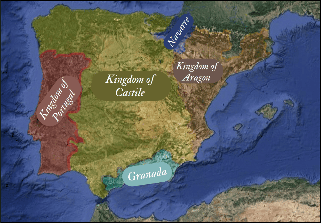
Geography has always shaped the decisions of states in history. The story of the Kingdom of Portugal, which had to abandon the habits it had acquired over centuries, is a case in point. For centuries, trade was indispensable for the Kingdom of Portugal, where brave sailors set sail from one corner of the Iberian Peninsula to discover more and more. The Kingdom of Portugal, completely confined to the Iberian Peninsula by the Kingdom of Castile (the predecessor of today’s Spain), had already turned its face to the sea and the vast horizons beyond.
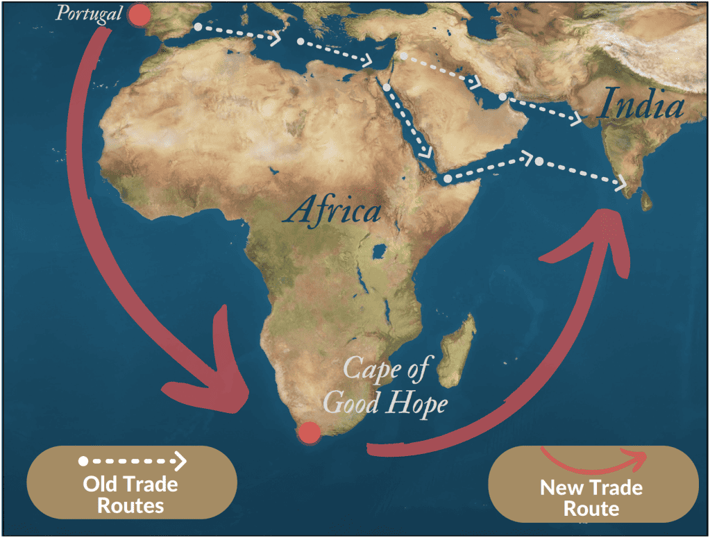
In the 1400s, Europe, struggling to break free from the webs of the Medieval Age, was trying to develop its trade with the eastern civilizations from which all kinds of clothing, spice, food, tools, etc. came. But there was also a rapidly growing neighbor that cut between East and West like a knife and gradually took control of the Mediterranean: The Ottomans. With each passing year, Europe’s trading kingdoms, such as Portugal and Castile, were becoming more and more hampered by the Ottomans. The Ottomans and other civilizations to the east demanded high taxes from these European traders. At the time, it was thought that the only connection between Europe and India was through the Mediterranean and the Middle East – so paying taxes to these civilizations was the only way through.
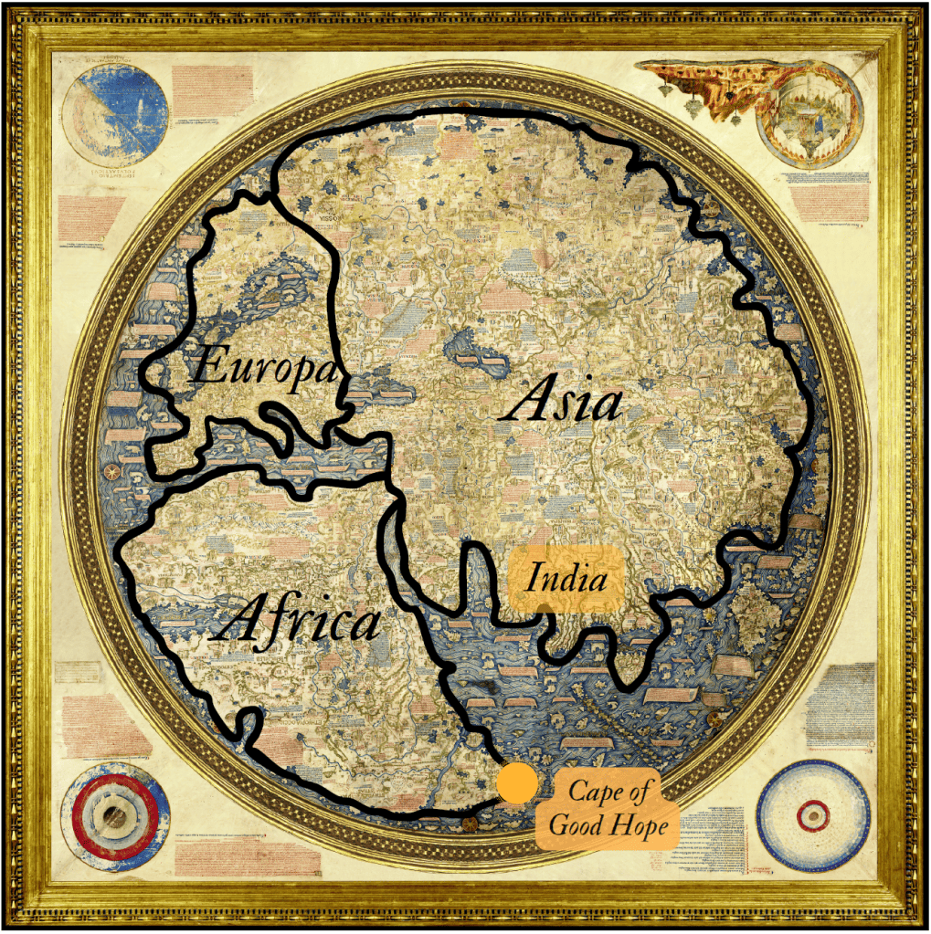
The Kingdom of Portugal, one of the most daring maritime civilizations in terms of self-determination, began to search for a solution. Among the archives owned by the Kingdom of Portugal was a map containing extraordinary information by a Venetian geographer named “Fra Mauro”. This map predicted that starting from Europe, one could reach India by going around the south of Africa. Although Fra Mauro does not specify exactly where he got this information from while compiling his map, it seems clear that Strabo’s writings gave him the idea.
Encouraged by this map and many other sources, King João II of Portugal put into effect a “B” plan to find a new trade route. Determined to try the south point of Africa, King João II put the plan into action by putting Bartolomeu Dias, who came from a seafaring background, in charge of the expedition.
The result? Dias made it. Of course, it was quite a challenge, as befits a place that had not been easily reached before. Because the cape is located at the confluence of warm currents from the Indian Ocean and cold currents from Antarctic waters, which is why there are violent storms and a rough sea. As the story goes, Dias called this cape as “Cape of Storms” because of the capsizes that almost cost him his life, but when he returned home and presented his discovery to his king, João II found it very promising for the country’s trade and renamed it the “Cape of Good Hope“.
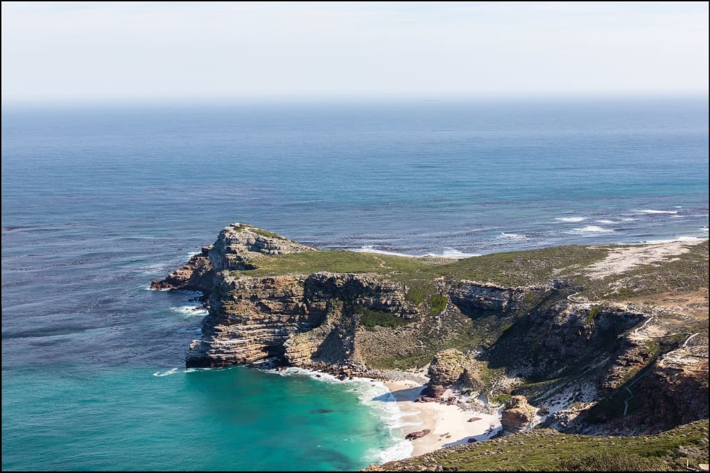
Photo by: Diego Delso, delso.photo, License CC-BY-SA
This route of discovery was used as the primary trade route by Portuguese sailors in the following centuries. As for Dias, despite his achievement, no official proclamation was issued and he received little recognition at the time.
